Monday, July 31, 2006

New Insight from Coyote Scat

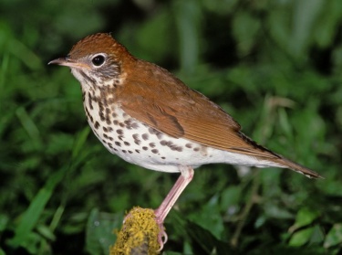
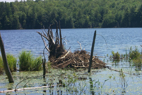
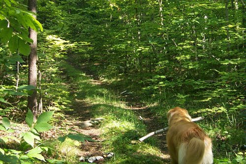
Every day, no matter where I hike, I find something new of interest. Early this morning Sophie alerted me to the presence of coyote scat on our mountain road. It wasn't much, and without her nose, I would've missed it completely. On closer inspection, I was interested to see that the scat was entirely made of partially digested, unripe, barely reddened blackberries.

Of course I know that coyotes love apples and pears, so it makes sense they'd go for other fruit. But I didn't realize that they'd go so far as to eat hard and sour unripe berries. It doesn't seem likely that they'd be so hungry that they'd go for food they didn't care for. As far as I know, there's been plenty of small animals around for them to eat this summer. So what explains this unsavory meal? I haven't a clue and am still puzzling it out.

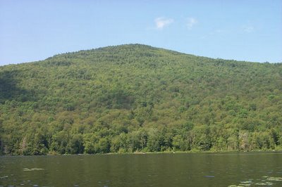
It's a Date: Bushwhack up Mount Blue after Labor Day

Hot weather alert for tomorrow and Wednesday, with temperatures here going up to 95 degrees. No excursions are planned. I'll probably end up studying land navigation in my cool living room. I'm planning some mountain bushwhacks for September, the best month for climbing in the Adirondacks.

Saturday, July 29, 2006

Morningside Nostalgia

Today I had some fun walking the trails at Morningside Camps and Cottages in Minerva. I'm going to be leading a nature walk there on Monday morning, so I was revisiting the trails, seeing what's new and interesting for people to see and touch.

Morningside is where Ken and I first encountered the Adirondacks. We started spending several weeks there in September every year, paddling and swimming in Minerva Lake, hiking the nearby trails, climbing mountains, and canoeing in the surrounding waters. Our friends Dave and Randi LaBar own and operate Morningside, and I'm so glad I'm going to be guiding some of their guests on their trails.


I found a few things there today that stumped me. Here's one of them. I found this unusual growth all over a rock. It's slimy and wet, the way a slug feels. I can hear the children saying "Eeeewwww!" I'm going to e-mail Evelyn Greene, the Adirondack naturalist par excellence, to see if she can identify it.

Thursday, July 27, 2006

What's Causing the Decline of the Songbirds?


Just what has been the cause of the decline of the wood thrush and many of its thrush relatives, the birds with the hauntingly beautiful flute-like songs in the forests of the Northeast?

The wood thrush population in New York has decreased by 45%, according to a major study recently completed and reported. (This NY Times article will not be available after a few days). Click here for a summary.

Analysis of the birds themselves has revealed that they have high mercury levels, a startling find considering that thrushes do not eat fish from mercury-laden waters. Where is all this mercury coming from? According to most reports, from coal-burning power plants in Ohio and other states in the Midwest. The contaminants fall as rain and enter the soil, where it is picked up by worms and insects, the food of the wood thrush and many other songbirds. It's been known for many years that mercury contamination has disrupted the reproduction of waterbirds, and, for the first time, it is now believed to play a role in the decline of the wood thrush.

With what we know about the relationship of coal burning and global warming, why are industries (and some consumers) still pigheadedly using it? Because it's cheap. Yeah, the same old song, cheap now, but our children and grandchildren will pay later.

Tuesday, July 25, 2006

Destination: The Mighty Hudson


Mike, my favorite fellow guide, and I trekked near the Hudson River today, exploring some trails thereabouts. I haven't seen Mike in weeks, because of our busy guiding schedules. It was fun to catch up on his paddling adventures in the northwestern Adirondacks. We also discussed some worrisome news about a loon stranded in a "pond" too small for the loon to fly out of. The loon is stuck in a quarry lagoon until the loon rescue folks can get down there and rescue him. In the meantime, the loon is doing fine, chowing down on tadpoles and the like. But it isn't safe for him to stay there indefinitely.

I was disappointed in the lack of variety of vegetation in the area, largely due to the large numbers of scotch pines that block sunlight, but I'll keep the trails on my list because they're excellent for beginning snowshoers and cross-country skiers. A good place for beginners to build skills before venturing out on winter wilderness jaunts. I'm already looking forward to those!

I did find a wildflower that took me by surprise, not because of its rarity, but because I haven't seen it yet in the Adirondacks--Butterfly Weed. Because the place I found it wasn't its usual habitat, I wonder if someone planted it there.

Sunday, July 23, 2006

Beaver Nation!

Heavy rain can be good for a guide, offering a weekend of enforced rest. I was grumbling about it Saturday, though, as I sat in my office contemplating my pile of paperwork. I puttered with it for an hour when I realized I was getting nothing accomplished. That's when I flopped down on my bed and read a murder mystery. I'm in the middle of my favorite kind of mystery--one that's dripping with atmosphere. The Lighthouse by P.D. James is perfect in this regard. It's set on an island off the southern coast of England. You know the kind: high cliffs, jagged rocks that wreck ships, one lonely mansion, peculiar people. Gotta love it.

Enough of my day off! I promised I'd blog about Friday, the day after my hiking fiasco that I described in my previous post.

I checked out a wonderful trail that leads to a secluded pond. Unlike the hike to Round Pond, this trail was clear all the way. (Eureka!) And the forest was open enough so that pond breezes kept me cool as I hiked. The most adventurous moments were when I had to make my way across a long beaver dam to reach the rest of the trail. Because I was carrying a waist pack rather than my usual backpack, I couldn't store my binoculars or my camera before I crossed this all too watery area. To prevent disaster, I had to stand more or less upright and keep my balance all the way. To prevent a spill, it would have made more sense to bend over and use my hands to break a fall.

As I maneuvered my way across, I couldn't help imagining how much fun my ten- and twelve-year-old friends would have scrambling over this amazingly constructed beaver obstacle. From the photo (beaver dam is on the right), it doesn't look as though water is on both sides--very deceptive.
I also encountered an area where beavers had felled massive hemlocks, one after another as if they were a bunch of pick-up-sticks.

And I discovered a most unusual beaver lodge: Hey, is that a tv antenna sticking up to the left?

Thursday, July 20, 2006

A Day in the Life of a Guide

Before I write about the guide's tale of woe and yesterday's adventure, let me say that today was a huge improvement--I found a fabulous new trail to add to my list of safaris. But I'm not writing about today today. I'll write about that in my next entry. Today I'm going to tell you what happened yesterday, because it provides excellent insight into the life of a hiking and nature guide.

This spring at various times I heard hikers and paddlers mention a trail that connects Garnet Lake and Round Pond, two gorgeous bodies of water. I was told that the trail climbs an interesting ridge, is moderately difficult, and offers a fun day. I had no clients scheduled, so as I do on such days, I went off in the hopes that I'd find an exciting safari for my customers.

I checked all the guidebooks and two topo maps. Nothing untoward was mentioned, everything seemed in order. I parked my car in the little lot by the trail at Garnet Lake and off I went. Right off the bat, I noticed there were many trees down over the trail. Depending on the size of the tree, this meant fighting my way through the vegetation around the tree or trying to climb over it. One after another, I crawled through them, around them, and didn't think too much of it. At first.

I didn't become concerned until I was about 3/4ths of a mile in. By this point trees covered the trail more and more frequently. All I was doing now was climbing over these obstacles. Forget paying attention to Mother Nature, looking at birds, ferns, and mushrooms. I was locked in a battle to forge my way forward. Although I did finally see one I've been hearing for a long time--Swainson's thrush. It sat as still as could be, just twenty to twenty five feet from me, so I could get a good long, delicious look.

To add insult to injury, the trail was marked only every half mile or so. It was so overgrown that I had to keep retracing my steps (climbing over trees I had already climbed over) to pick up the trail again. Sweat dripped down my face and back and mosquitoes went up my nose and in my ears.

When I was a little over a mile in (the trail to Round Pond is 2.3 miles), I contemplated turning back. It was clear that this was no trip for my clients. If I ever have a tour category "Safaris for Masochists," this trail will be on it, but I'm not into pain, so I'm not planning on venturing into this domain. I decided I'd continue because 1) the trail might open up, and 2)I wanted to finish what I set out to do.

View of the Marsh by Round Pond

I arrived at Round Pond, scratched up, dejected, and sad. It's clear that this trail was once a beautiful, well maintained route. Snowmobilers once used it, skiers, and snowshoers. But no longer. The forest has all but reclaimed it. Why has this happened? Well, the fact is, the Department of Environmental Conservation, particularly the sub-department that includes the forest rangers, does not have the funds to maintain even a fraction of the trails in the Adirondacks. Governor Pataki has slashed the department's budget so many times, the resources to maintain our Adirondack trail heritage is not there. And so it goes.

So there I was on the shores of Round Pond with more than two hours of torture behind me. Time to go home. I decided that there was no way I was going back the way I came. I pulled out my compass and map and set a route to the northeast to reach the other trail that leads into Round Pond. I'd bushwhack my way to this trail, hike out, pick up the road, and walk the 4-5 miles back to my car. At least I'd have no obstacle to block my every step. And that's what I did. Another trail tested and rejected--all so my clients don't have to experience such a day.

Tuesday, July 18, 2006

Where to Hike When It's Super Hot

I've been on a mission lately searching for really cool trails. As regular readers of this blog know, my Watch Hill Safari is perfect for days when the mercury hits the mid-80s to 90. (Scroll down to my July 10 entry.) Do I hike when it's above 90? When those sizzlers are predicted, I guide clients on nature walks for three-hour excursions in the early morning hours, when the dew still sparkles on the grass and the birds' songs fill the forest.

Yes, you say, but you haven't answered the question.

Do I personally hike when it's over ninety? Well, to be truthful, I regret to say that my body has failed me in extreme heat. Despite my persuasions, it has proven itself physically incapable of handling any type of hiking as soon as temps hit the nineties. Fortunately, the Adirondacks rarely has days that exceed ninety degrees.

Roaring Brook on the Schaefer Trail--Gore Mountain

On hot days in the 80s, I take people to trails that cross or parallel running brooks, where we can stop, take our boots off, and cool our feet before continuing to climb. I also guide people along trails that lead to ponds or lakes, where the air temperature will feel six to ten degrees cooler.

Garnet Lake

Sunday, July 16, 2006

Adk Safaris: Now a Business Partner of the Adirondack Museum


Saturday The Adirondack Museum was hosting a Gardening Festival, and since I delve in the digging arts from time to time, I just had to be there. I decided it would also be a great time for Adirondack Safaris to become a business partner of the museum that has been so important to the entire Adirondack Park.

I enjoyed a tour of the museum gardens, a lecture on gardening with shade plants in the Adirondacks, and I visited the gardening vendors displaying their wares. I bought a smallish pot overflowing with parsley, though I wanted to bring home every daylily variety I saw. By the time I was finished with all the gardening events, I was too tired and hot to visit the exhibits, but managed to browse in the museum shop, which has an exquisite, comprehensive selection of books on the Adirondacks. Plenty of time for the exhibits on my next visit.

The day was overcast and very hazy, yet intense July sunlight made these flowering annuals on the balcony overlooking Blue Mountain Lake really stand out.


Please scroll way down for the link to Adirondack Safaris and the Archives.

Friday, July 14, 2006

July's the Time for a Butterfly Safari


Wildflowers are everywhere, and so are the butterflies. This Aphrodite Fritillary sucking nectar from a clover was very cooperative. Unlike several other buttefly varieties in the neighborhood recently, the Aphrodite is not camera-shy. It's smaller than a Swallowtail, but just as beautiful. On any sunny day in the past month, all I've had to do is stand still in a field or meadow and butterflies will appear. Hey, it's not only children who love to run through the grasses and wildflowers with a butterfly net in hand.

I've had no luck at all photographing the Monarchs that have been going insane with happiness over the flowering milkweed. They are so skittish--I've been more successful getting them to sit still for a moment during their September migration.

Wednesday, July 12, 2006

Off to Hunt for a Paint Mine

That was my goal yesterday when I once again told myself that this excellent hiking weather (less humidity and high seventies) cannot last. I hiked into the valley between Crane and Huckleberry Mountains to search for the ruins of a nineteenth-century paint mine.

I know "paint mine" sounds strange, but that's the name of this woodsy historical landmark. The rock and soil in parts of this area contain a red pigment that was once used to cover farm buildings. The mine was quite an establishment in its time, and its paint, "Johnsburg Red," was known far and wide.

Crane Mountain, through the trees

As I hiked along en route, I was comforted by the silent, massive presence of Crane to the north. Once again plagued with an old guidebook that desperately needs a revised edition, I overshot the spot by nearly a mile. The forest is camouflaging the old stones and buildings very well. On my way back, I walked more slowly and scrutinized every tree and bit of woods. Persistence paid off, and I must say I'm glad, because I wasn't going home until I found it. Ruins of stone foundations and buildings, a paint pit, and a magnificent stone chimney were there for inspection.

A perfect hike for history enthusiasts--my next job is to talk with the Johnsburg historian and find out more. Yet history is not the only attraction on this hike. Birds common to boreal forests are everywhere as well as enormous granite rocks, some as tall as a 2- to 3-story building. Great fun for children who love to climb!

Monday, July 10, 2006

Perfect Hike for a Sizzling Hot Day


Yes, combining a hot day with a mountain climb is not always a comfortable form of entertainment, especially for folks who are new to climbing.

On Saturday, I visited a charmer--a place known as Watch Hill--that fits the bill for adults and children who are beginning climbers, or for veterans who want some exercise and some gorgeous mountain views without dying of heatstroke on a sweltering day.

The Watch Hill Trail is almost totally unmarked, and is extremely difficult to locate from Route 30 between Indian Lake and Speculator unless you know where to find it. Yet it's a trail worth all the trouble as I discovered on Saturday. Forests that are mostly or partly composed of hemlocks are very cooling, and this trail has 'em. You may have noticed that when you leave a sunny, open area or a deciduous and pine tree area, the temperature drops considerably when you walk into a hemlock forest.

The Watch Hill Trail has loads of hemlocks, and better yet, the steep inclines are all in the hemlock shade. (If only I could order this for all my summertime climbing!) The hiker emerges from the hemlocks only at a wide, sunny ledge with a terrific view of Snowy Mountain, and at the summit where the ledges afford a knockout panorama of the southern sections of Indian Lake.

This trail is perfect for children who are new to climbing, because in a relatively easy half-day hike, they reach a peak where they can experience the euphoria of attaining a summit. The hike is also short enough that I will be offering it to clients who have children as young as six years old.

Saturday, July 08, 2006

Schaefer Trail Redux


View of Crane Mountain from Gore

(Note: For a photo of Gore Mountain, click on "June 2006" in the Archives. Scroll down to find the June 26 entry. To read about my climb up Crane Mountain this spring, read the June 16 entry.)

I climbed the Schaefer Trail yesterday, revisiting Gore Mountain. This time I had the card in the camera, but the haziness made for some less than spectacular pics. Next time--maybe in the fall when all the sugar maples turn that brilliant combination of orange, yellow, and red?

This time I had no trouble sticking to the trail, because once you're on it, it's extremely well-marked. Problem is, without instructions, a person may be hard-pressed to find the spot where the hiking trail crosses the ski trail. The laminated instructions at the trail register work only if you happen to know the names of the old North Creek Ski Bowl trails (no longer operating). Enough about that. Let's talk trail talk.


The appeal of this trail is two-fold: 1) Don Greene designed the Shaefer over a long period of time. During this period, he climbed Gore everyday "just for the fun of it." He wanted the trail to highlight the mountain's wild, rugged beauty, to capitalize on mountain ledges for glorious views, and to steer the trail away from areas prone to flooding and muddiness. 2) The trail leads the hiker up, but gradually. If someone were to name the most difficult part of the trail, they'd probably point to the beginning. All it requires is walking a wide, steep trail up. No other hazards. After that levels out, you march steadily uphill, but the grades are not as taxing as you might expect for a mountain that's 3,600 feet at the summit.

Who would want a Gore safari? Gore skiers of all ages, for sure. It's fun to see the Saddle Lodge appear through the trees. (Oh, how I love the view of Mt. Marcy and other High Peaks from there). Your reward is also knowing that you're now at about 3100 feet or so. It's fascinating to climb up "The Cloud," the ski trail that commands some other beautiful mountain views to the north and east. And then it's just a short ways to the summit.

Thursday, July 06, 2006

Hiking up Gore Mountain

The Schaefer Trail is the hiking trail that leads to the summit of Gore Mountain (elevation 3,600 ft.). Today I signed in at the register for the Schaefer but as I climbed I managed to overshoot the spot where the trail crosses a Gore Mountain ski trail. I ended up by the old North Creek Reservoir, an intriguing spot, but not where I wanted to be.

I'm not familiar with the Schaefer Trail because I've been focusing all my explorations to true wilderness trails, and the Schaefer, despite its beauty, many attractions, and wild places, leads up a developed skiing mountain that is a far cry from wilderness.

Even so, I was happy to be climbing a dry trail. And I loved finding a meadow crowded with blooming milkweed. I stayed for quite a while and watched the butterflies, bees, dragonflies, and a ruby-throated hummingbird feed themselves. The entire climb up is lush with wildflowers. When the trail crosses Roaring Brook, there is a rushing waterfall that's cooling after a hot climb.

So I think, maybe I should add a Gore Mountain adventure to my list of safaris. After all, I do believe that only a few (those with AMC guides) will figure out how to stay on the Schaefer Trail and make it to the summit.

I'm going back tomorrow, this time with said guidebook and with the card in the digital camera (not sitting at home as I did today) and see how the rest of the trail is.

Photos tomorrow!

Tuesday, July 04, 2006

So There Is a Link to Fish Ponds!


When Mike and I paddled Cod Pond a couple of weeks ago, we were searching for the stream or flow that leads to Fish Ponds. We paddled and paddled, looked and searched, but found nothing. Yet Evelyn says she's done it, and indeed, last Friday she collected a few of her friends and paddled out the flow. They didn't make it all the way to Fish Ponds, she says, but after all the rain, they were able to slide over most of all the beaver dams, rather than carry the boats over them, a task that is a muddy pain, in my opinion.

Mike and I are still stymied about the route, but last night at a Fourth of July cookout at my place, he and Evelyn spent a good bit of time with their heads bent over several topo maps. I hope to be able to paddle that stretch because that is wild, wild country back in there.

I had a marvelous time talking to Evelyn's husband, Don Greene, who engineered the Schaefer Trail that goes to the top of Gore Mountain. I asked him my most pressing question about the route and one that all hikers are considering this summer. "How wet is it?" "Not a wet trail at all!" he answered. "Before I made the trail, I studied and studied that mountain, walking up and down it hundreds of times to find the driest way up."

So climbing Gore (elevation 3600 ft.) would be a great way to get my climbing legs back in shape after this interlude of weather. I had thought that it was too heavily traveled a trail for my clients, but this may not be the case. I'll give it a try this week.

Saturday, July 01, 2006

Testing the Trails

I spent most of Friday going from trail to trail to test conditions after all the rain we've had. The notoriously wet ones I didn't bother to venture to, but the rest I checked out. In the early morning, Sophie and I tested the full length of the Moss Ridge and Swamp Trail--most of it is in terrific condition but for one muddy stream crossing. I tooks some photos, but early morning pics of woodsy trails do not come out well, though I did catch this one of Sophie carrying a birch stick.

Milkweed is on the verge of flowering, and the butterflies are hanging around in anxious anticipation. When all the milkweed blooms, I'll be out with a butterfly net and my field guide, getting up close and personal with them for a few brief moments before letting them go back to their business. This coming week is prime time for butterfly lovers. I just received a small shipment of nets for my clients.

At Cod Pond, I once again photographed some White Admiral--Red Spotted Purple hybrids. I guess there must be something nutritious about the new growth on this plant; I just hope they can hang on until the milkweed blooms.